|
|
In 2006, the choir director of the Herbertscher Choir in the city where I live made a decision to travel to England to sing with our partner choir, the Silver Ring Choir of Bath. Jokingly, when one of the members of the choir asked me how I would get there, I said, “By bicycle, of course!” “You’re kidding,” he answered.
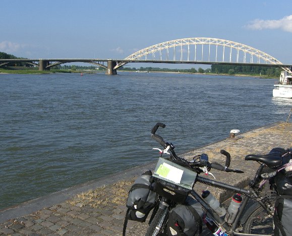
After thinking about it, I decided it wouldn’t be such a bad idea. And so 3 weeks before the rest of the choir, I hopped on my bicycle and off I went. This first picture is just accross the border of Germany in the city of Nijmegen, Holland.
Click HERE for the newspaper article in the Bath Chronicle!
|
|
|
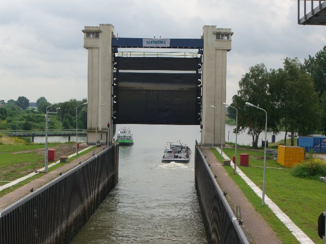
Holland, or the Netherlands, as they like to be called, is a very flat land filled with canals and locks. This lock, near the city of Nijmegen, opens from the Rhine River into a canal that continues south into the countryside.
|
|
|
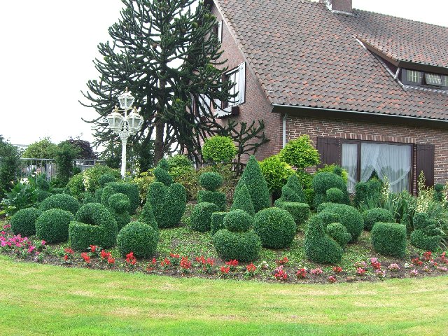
After zipping southwest across Holland at a rate of 120 kilometers per day, I entered Belgium just north of Antwerpen. As you can see here, the Belgians love to dress up their lawns with bushes that are shaped into attractive groups of interesting objects. This one includes ducks, hearts, soft-whip ice cream, and a pacman figure.
|
|
|
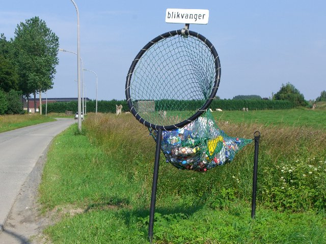
The Belgians have an interesting way of solving the litter problem on the highways. This “basket” is placed at various intervals along the highways and provides interesting “sport” for motorists that would otherwise be tempted to litter the highways with plastic bottles and cans. The highways are amazingly free of litter in this country.
|
|
|
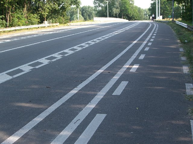
The last time I was in Belgium, there were very few bicycle trails. Entering the city of Ghent, this highway totally surprised me. The lane on the far right is for bicycles; the next lane is for motorcycles, and the next lane is for cars. The lanes narrow on bridges, but open up again on the other side. A perfect solution considering the increase in bicycle traffic.
|
|
|
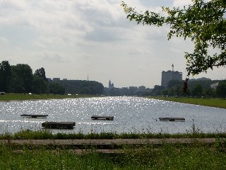
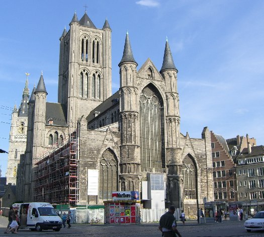
Ghent, the most beautiful city I’ve seen in Belgium, is filled with narrow streets filled with small cafés and pubs, and students everywhere doing all kinds of sports. On the west side of the city, there is a beautiful long rectangular artificial lake that is used for paddling canoes and long boats and is surrounded by a green lawn where people can be seen lounging and picnicking in the sun.
|
|
|
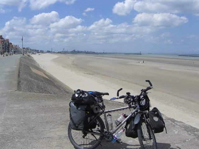
By the middle of the next day, after 3 1/2 days of biking, I reached the English Channel at Dunkirk. The beaches here are wide and sandy.
|
|
|
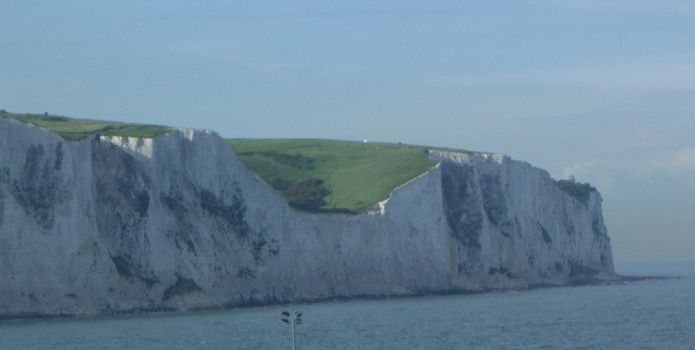
The white cliffs of Dover were an impressive sight as I approached England on the fourth day of the trip. On land, I rode the bike up the back of the cliffs to see Dover Castle. 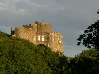
|
|
|
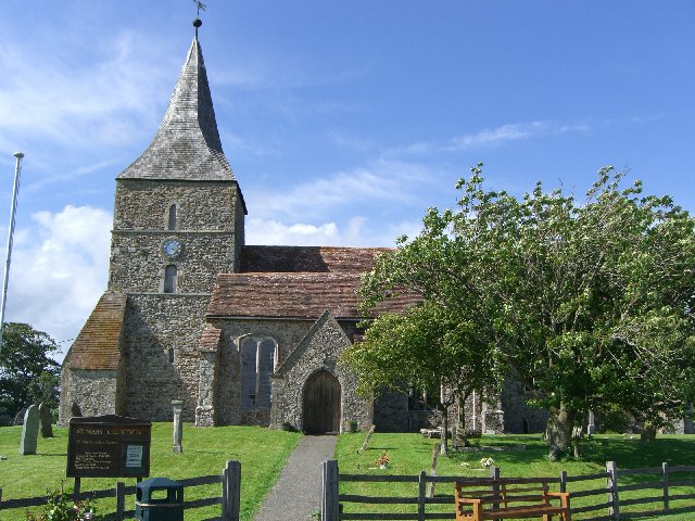
St. Mary’s
Arriving in England, I found a land of stone churches and friendly inhabitants.
|
|
|
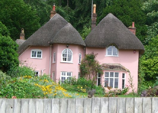
Quaint houses with thatched roofs dotted the countryside from Kent to Wiltshire.
|
|
|
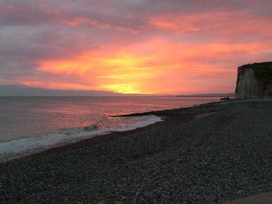
After a weather report threatened 3 days of solid rain, I boarded a ferry back across the English Channel to Dieppe, France. Just a few kilometers south, I discovered why Claude Monet, the famous French painter, decided that the coastal town of Pourville was his favorite place to paint. This sunrise at 4:19 a.m. was the most beautiful I’ve seen in my life.
|
|

|
Back in England, I found out why Brighton was the choice city for British royalty. A beautiful coastal city, Brighton boasts of the best weather in England and is a favorite tourist stop in the country. This photo is of the Royal Pavillion built for the Prince of Wales.
Brighthelmstone (as Brighton was originally called) was transformed from a small fishing town into a fashionable resort in the mid 18th century through the discovery of the therapeutic effects of bathing in and drinking sea water. The success of this cure, promoted by Dr Richard Russell, drew fashionable society to the town to take the waters. As Prince of Wales, George IV first visited Brighton in 1783, aged 21, partly on the recommendation of his doctors who thought that the sea water might ease the swellings in the glands of his neck. He also found the relaxed atmosphere of the town a welcome relief from the constraints of the staid and stifling court of his father, George III.
What to see in the Royal Pavillion? Queen Victoria’s Bedroom, what else?
|
|
|
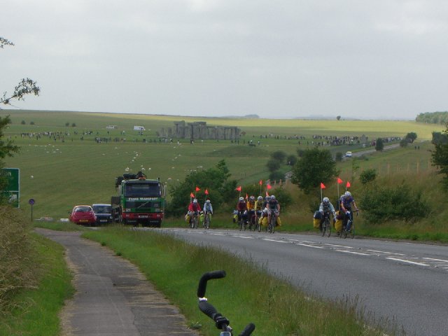
Near Stonehenge, I was surprised to see a group of about 40 cyclists holding up traffic with about 50 vehicles behind them. No joke. Except for the National Cycle Paths, which aren’t many, you either have to ride the bicycle on the road or on the footpath (which is illegal in England). On busy highways like this one, I choose to ride on the footpath. The same day, I met another biker coming toward me from the other direction on the footpath -- a policeman. He chose the safer path as well. So much for that silly law.
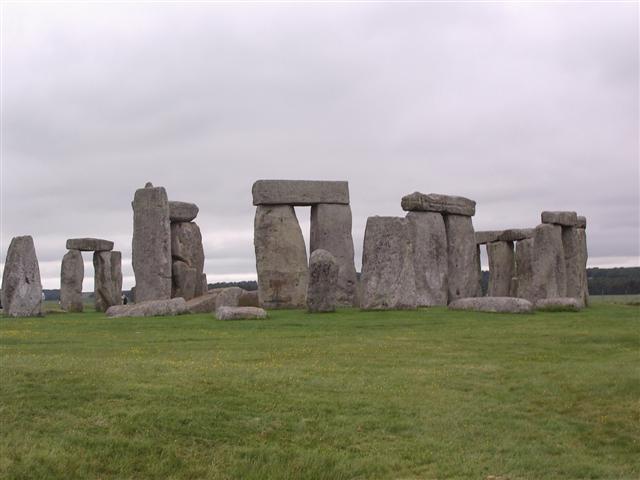
Stonehenge is a prehistoric monument located in the English county of Wiltshire, about 8 miles (13 km) north of Salisbury. One of the most famous prehistoric sites in the world, Stonehenge is composed of earthworks surrounding a circular setting of large standing stones. Archaeologists believe the standing stones were erected around 2200 BC and the surrounding circular earth bank and ditch, which constitute the earliest phase of the monument, have been dated to about 3100 BC. The site and its surroundings were added to the UNESCO’s list of World Heritage Sites in 1986 in a co-listing with Avebury henge monument, and it is also a legally protected Scheduled Ancient Monument. Stonehenge itself is owned and managed by English Heritage while the surrounding land is owned by the National Trust. (Wikepedia)
|
|
|
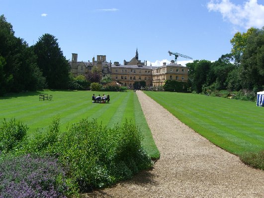
On the way to Bath, I stopped in Oxford to visit the famous university. I was surprised to learn that Oxford University is made up of 39 independent colleges.
Oxford is well worth the visit.
This photograph is the rear entrance to St. John’s College, the college attended by Tony Blair.
|
|
|
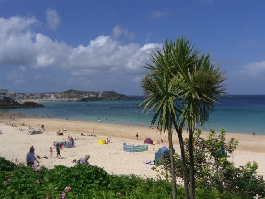
After singing with the Herbertscher Choir in Bath, my wife, Angela, and my son, Christian, joined me in a long train ride to St. Ives in Cornwall. St. Ives is the most popular vacation resort city in all of England - and you can see why. It looks more like a Mediterranean City. The climate here is mild enough that palm trees grow all year.
|
|
|
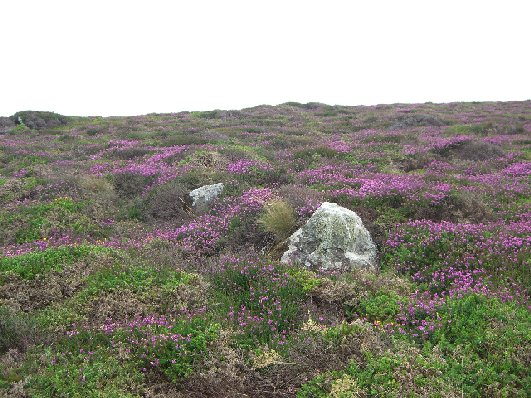
On a hike along the Coastal Footpath, Christian and I stumbled upon an enormous field of heather blooming in the sunshine - a beautiful sight to behold.
|
|
|
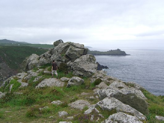
The South West Coast Path starts at Minehead in Somerset and runs along the part of the Somerset Bristol Channel coast, across North Devon, right round Cornwall, then along the South Devon and Dorset coasts to Poole Harbour. This is a distance of 630 miles which is over twice the distance of the Pennine Way and makes it by far the longest National Trail in Britain.
That’s my son on the path somewhere between St. Ives and Zennor.
|
|
|
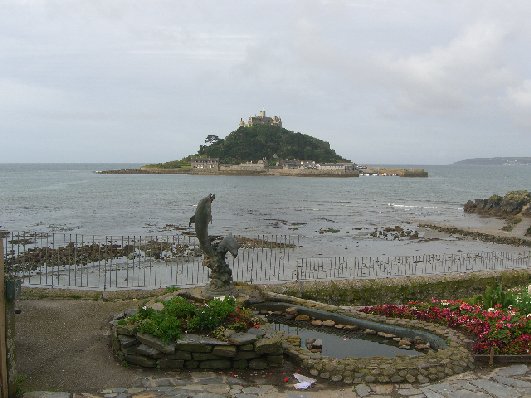
St. Michael’s Mount in Cornwall at medium tide.
|
|
|
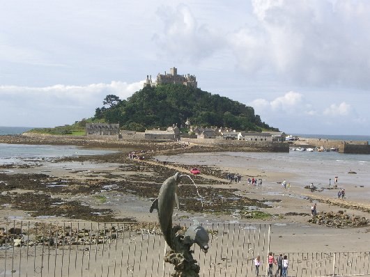
St. Michael’s Mount at low tide.
St Michael’s Mount is unique; a tiny, rocky island with a medieval castle that is still home to a modern family. A tranquil, beautiful location.
|
|
|
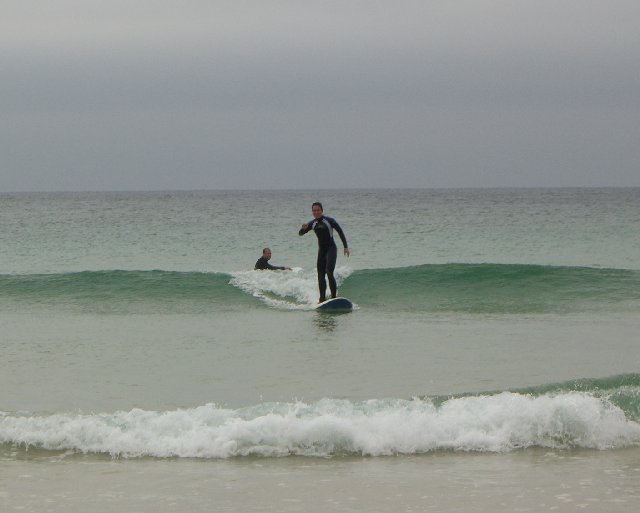
Christian learning to surf at Porthmoer Beach in St. Ives.
|
|
|
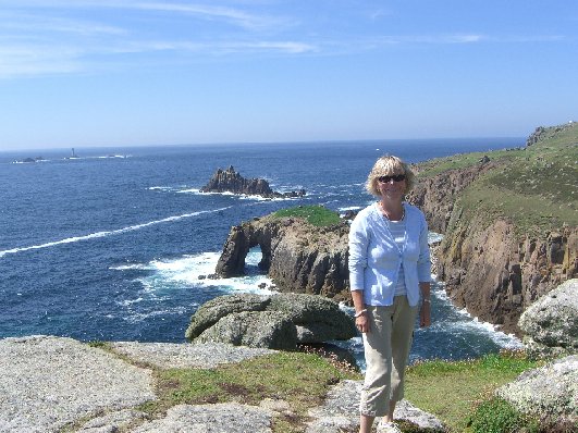
Angela at Lands End -- the furthest point west in England.
|